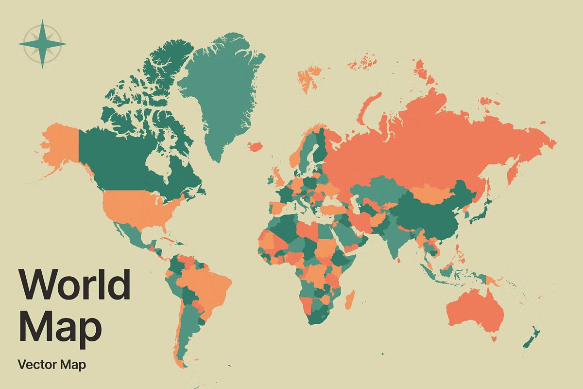
Unlock creative freedom with the **World Vector Map Stylized Illustration**—a masterfully crafted, fully scalable, and professionally layered vector map designed for designers, educators, marketers, and creators who demand precision, flexibility, and visual impact. Built with clean vector paths, this map ensures flawless quality at every size—whether you’re designing a poster, crafting a brand identity, or developing an interactive digital experience.
Professional-Grade Files, Fully Editable and Customizable
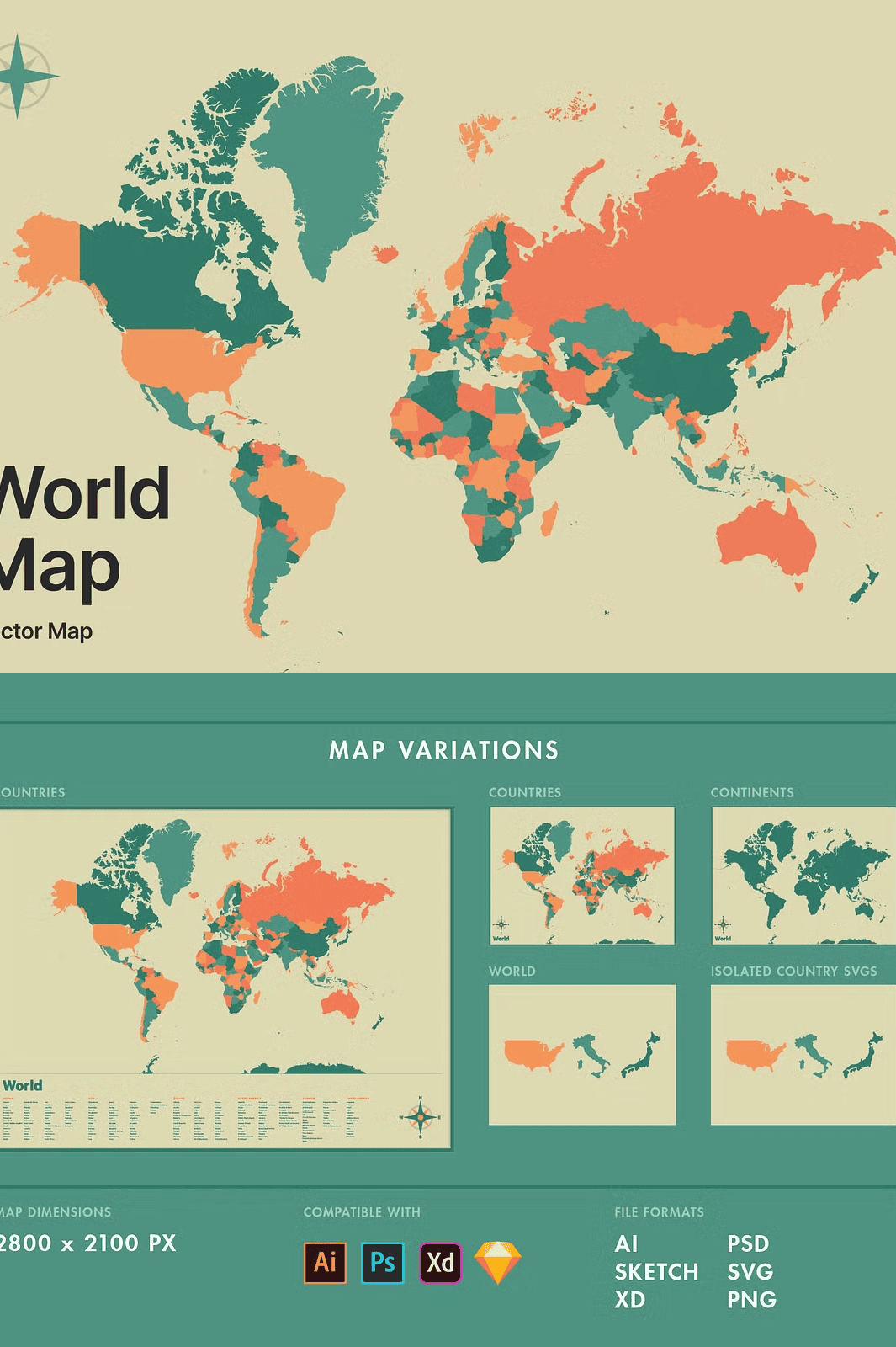
Every file in this collection is meticulously organized and labeled for instant usability. You receive:
- Illustrator (.AI) – Full layer control for seamless color, shape, and label editing.
- Photoshop (.PSD) – Layered file with intelligent groups for easy customization.
- Adobe XD (.XD) – Ready for prototyping, UI/UX design, and digital storytelling.
- Sketch (.sketch) – Optimized for Mac-based design workflows and component-based systems.
- SVG – Perfect for web integration, responsive layouts, and animation-ready graphics.
- PNG – High-resolution raster image for quick previewing or non-vector usage.
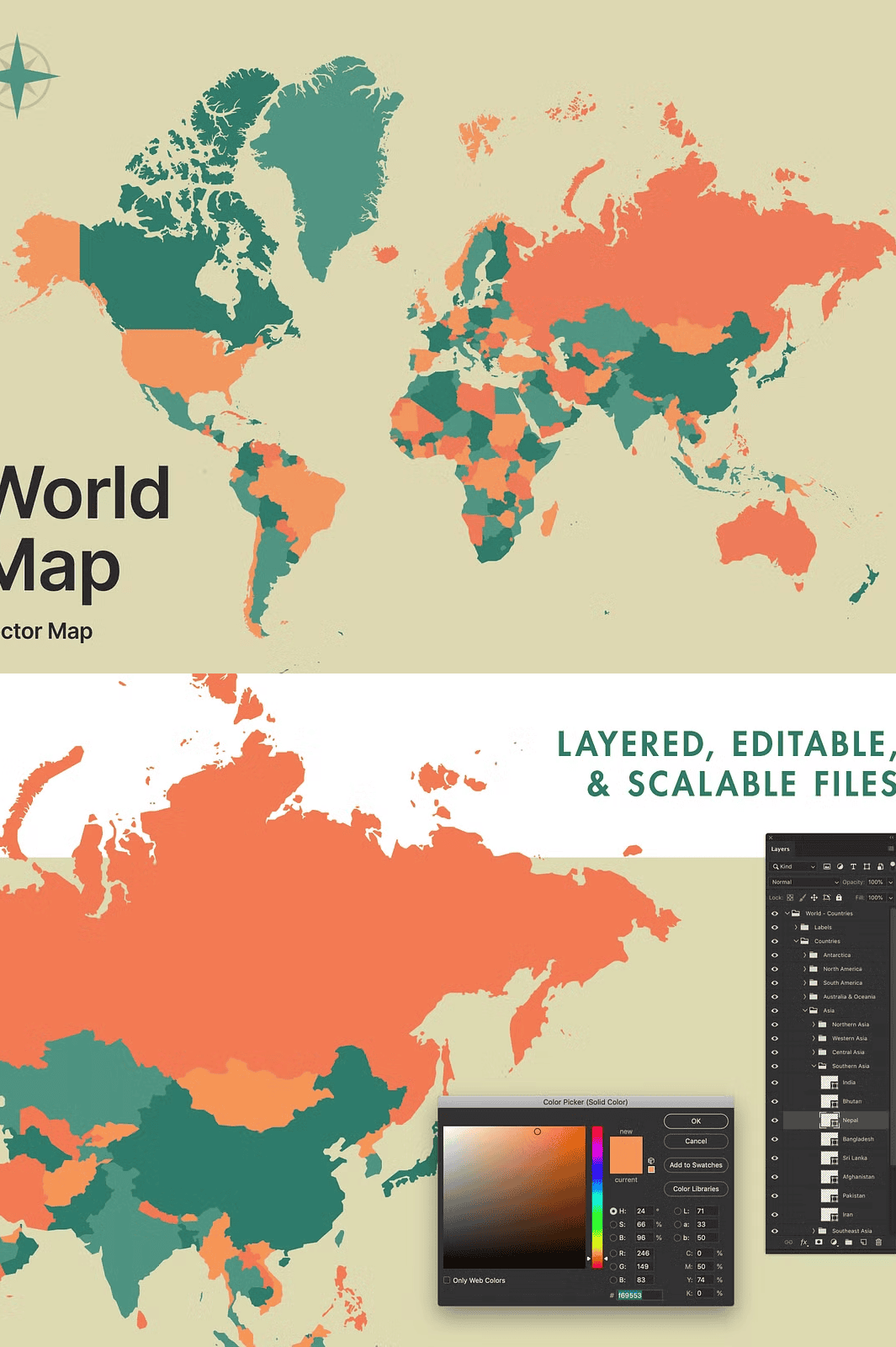
Each component is cleanly named and structurally organized, so you can locate and modify any region, country, or label in seconds—not hours. Change colors, hide continents, highlight regions, or add custom borders with just a few clicks.
Enhanced with a Country Name Variation (Updated December 3, 2019)
Now includes a new map variation featuring visible country names, making it ideal for educational materials, travel content, and presentation design. The labeling is cleanly integrated, avoids overlapping, and uses a modern, minimalist font style for maximum readability. The country name layer is separate from base shapes—so you can enable, disable, or customize labels based on your project’s needs.
Comprehensive Map Coverage with a Stylistic Edge
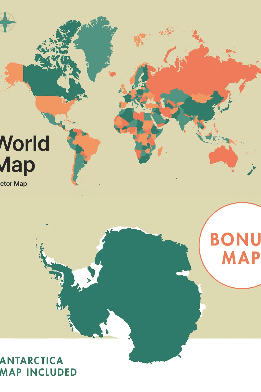
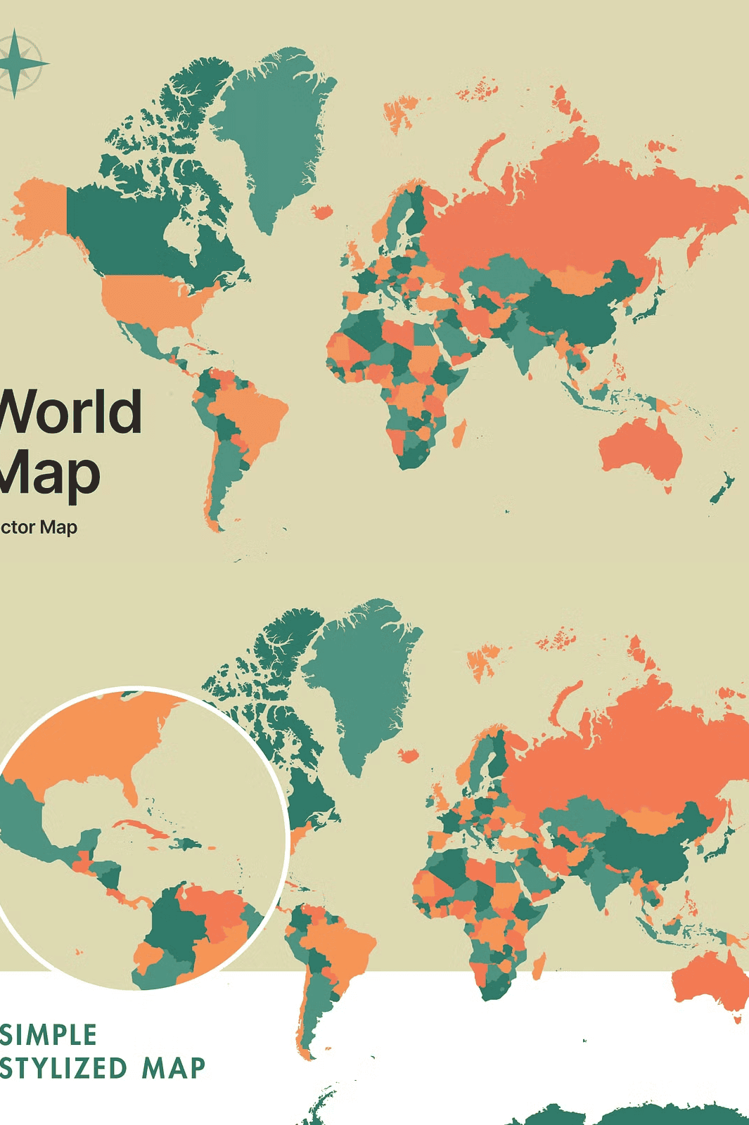
This is a stylized illustration, not a geographic atlas. While it captures the broad layout of continents and major landmasses with clarity and elegance, it intentionally simplifies borders and removes minor islands due to its artistic focus. This approach ensures a clean, balanced composition that works beautifully in branding, mood boards, or abstract visual storytelling—without visual clutter.
- Bonus Map Included: Antarctica vector map—perfect for polar-themed projects, scientific infographics, or travel branding.
- Designed for Creativity: Not bound by cartographic accuracy? That’s the point. This map is built for aesthetic impact, conceptual design, and visual metaphor.
- Effortless Adaptability: Use it in presentations, mobile apps, dashboards, or as a background in digital art.
Instant Access, Instant Results
After purchase, you receive immediate access to all file formats. No waiting. No complications. Just pure design power. Whether you’re a freelance designer, educator, startup founder, or creative developer, this map integrates into your workflow with minimal effort and maximum impact.
Use it to build interactive maps, highlight target markets, create travel-themed content, or design immersive brand experiences. Its versatility is unmatched—ideal for social media graphics, product packaging, website headers, and presentation slides.
Support and Feedback Welcome
Have questions about the files? Need clarification on layer naming or color editing? Don’t hesitate to message the creator—your success is their priority. The designer is responsive and committed to helping you get the most from this resource.
Start Designing with Confidence Today
Stop wasting time searching for editable, high-quality maps. This fully customizable, artistically refined vector illustration is exactly what you need to elevate your next project—quickly, professionally, and with zero compromises.
Join thousands of creatives using this map for impactful visual storytelling. Explore more from the designer: [CreativeMarket Profile – Ben Buysse](https://creativemarket.com/benbuysse).